Category Archives: Science

THE BOARDS

Here are some of my Pinterest Boards that you might find useful:

Pinterest Account

They include boards on subject matter ranging from Archeology, Business, Gaming, and History, to Science, Mathematics, and Writing, Literature, and Poetry.

NEW WYRDROAD

Some interesting new material on Wyrdroad. Some archaeological, some historical, some scientific, some gaming related, some entertaining.

WYRDROAD

WYRDROAD

I have established a new Facebook Gaming Group.

I haven’t had much time to build up the membership yet because I’ve been busy but I have tried to build up some interesting content. The primary interest of the group is gaming, but like this blog it will cover history, archeology, warfare, science, technology, fantasy and science fiction, literature, pop culture, comics, etc.

You’re welcome to visit and to join. Just hit the links provided.

WYRDROAD


NornsOld4

WORLD WAR ZERO – DESIGN OF THINGS TO COME (AND PAST)

WORLD WAR ZERO?

Indeed, as I’ve been saying for decades, the First World War did not begin in the 20th century. Hell, the First World War of the modern era didn’t even begin in the 20th Century. That’s just a common, modern-era-minded conceit of modern people. A mere and entirely erroneous nomenclature. Historians are every bit as absorbed in their own prejudices and misguided assumptions as anyone else.

World Wars, depending on precisely how you define them at any given time may extend well back into pre-history. What the Zero-Point really is we may never know, but it extends well, well beyond our age.

Something to remember about Real Life, something to remember in constructing your fiction, and something to remember when constructing your milieus and game worlds as well.

Just because the events are long lost to time doesn’t mean the effects are…


Archaeologist Talks About A Bronze Age ‘World War Zero’ That Brought Down Three Ancient Civilizations

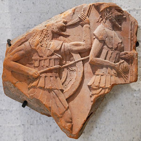
Back in March, we talked about a 3,200-year old massive battle that took place in the cultural ‘backwaters’ of Bronze Age northern Europe (circa 13th century BC), and how this mysterious encounter involved over 4,000 well-armed men from different regions, including Poland, Holland, Scandinavia and even Southern Europe. Intriguingly enough, there also seems to be a date-oriented significance relating to 13th century BC. Within a generation of these contemporary times, the increasing scale of warfare and over-arching political affairs seemed to have swept through many parts of the known world, including the eclipse of the Mycenaean Greeks, the invasion of Egypt by the ‘sea-people’ and the concurrent downfall of the Hittites. And furthermore, there is also the literary narrative of the Trojan War – a large scale conflict (and possibly the proverbial ‘last hurrah’ of the Mycenaeans) that pitted the Greeks against the mystifying Trojans. Considering all these ‘mega’ events of the ancient times, archaeologist Eberhard Zangger has alluded to what he calls ‘World War Zero’ – a seemingly cataclysmic scenario that severely affected and ultimately shattered the thriving nature of eastern Mediterranean Bronze Age civilizations.

According to Zangger, the so-called ‘World War Zero’ (or at least some parallel event) was possibly triggered by the emergence of a more powerful Bronze Age civilization in the proximate region. According to him, this faction – often overlooked by historians, probably pertains to the Luwians, who were based in ancient Anatolia. So who exactly were these Luwians? According to Britannica

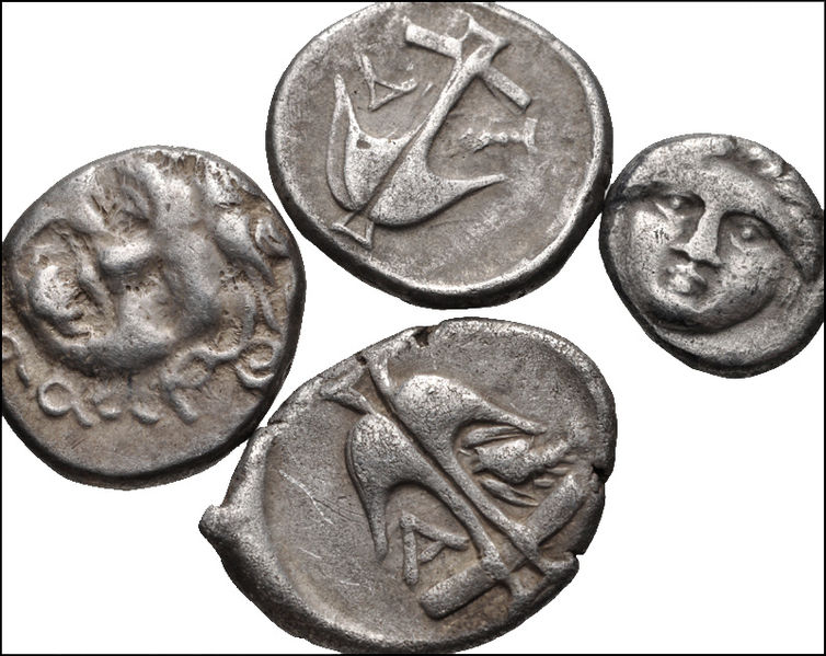
Luwiya is mentioned as a foreign country in the Hittite laws (about 1500 bc). It probably coincided roughly with Arzawa, a large region composed of several principalities in western or southwestern Anatolia, and Kizzuwadna, a district occupying the Cilician Plain. Both Arzawa and Kizzuwadna were independent kingdoms during the Old Hittite period (c. 1700–c. 1500 bc) but later became vassals of the Hittite empire. Linguistic evidence testifies to the cultural penetration of the Hittite empire by Luwians.

As for this seemingly ‘wild’ conjecture put forth by Zangger, the archaeologist (who is also the head of international non-profit, Luwian Studies, based in Zurich, Switzerland), the Luwians were intrinsically powerful because of the availability of natural resources in western Anatolia, including the region’s rich minerals and metal ore deposits. Moreover, based on satellite imagery, it has been found that the proximate areas of Anatolia were quite densely populated by Bronze Age standards, with evidences of around 340 big settlements found in the region.

Now regarding literary evidences, as the last sentence of the Britannica excerpt confirms, Hittites were already aware of the rising power of the collective kingdoms of western Anatolia, many of which had the lingua franca of Luwian. In fact, historically some of these ‘Luwian’ factions did unite together (periodically) to make their forays, raids and even invasions of the nearby Hittite lands. One of such major incursions, along with pressure from the eastern Assyrians, might have brought about the ultimate downfall of the Hittite empire.

Zangger continues with his conjectural narrative about how these victorious Luwians then (perhaps) coveted the rich lands of the Egyptian realm. Thus come in the Egyptian texts that document the arrival of so-called ‘Sea People’ – who could have been the Luwians sailing across from ‘distant’ Anatolia to raid northern Egypt. Finally, threatened by the warmongering and other baleful international affairs, the Mycanaean Greeks braced up for an imminent invasion by the Luwians – by attacking the enemy first through their own large offensive, as described in Homer’sIliad. However on nullifying this external threat from Anatolia (aka Trojans), the Mycanaeans squabbled among themselves, and soon civil wars snuffed out their flourishing culture – as hinted at in Homer’s Odyssey.

But of course, from the historical perspective, this expansive (and world-changing) sequence of events of World War Zero is entirely hypothetical – with no exact clue pointing to Luwian dominance in contemporary political affairs. However from the archaeological context, researchers have come across ruins of many Anatolian settlements (circa late Bronze Age) that bore the destructive marks of warfare. Furthermore, since we brought up history, there are rare occurrences of ‘latent’ powers being ultimately responsible for toppling the more conventionally powerful empires, in spite of their relative unfamiliarity in global affairs. One pertinent example would obviously include the burgeoning Islamic realm (after Mohammed), circa 7th century AD, that managed to defeat two contemporary ‘superpowers’ of the time – the Eastern Roman Empire (Byzantine Empire) and the Sassanian Persian Empire, to claim their subsequent Caliphate.

In any case, beyond conjectures and mirroring events, there is the whole science of extant evidences to consider. These evidences could include both textural works and architectural specimens. As Christoph Bachhuber at the University of Oxford, said –

Archaeologists will need to discover similar examples of monumental art and architecture across western Anatolia and ideally texts from the same sites to support Zangger’s claim of a civilization.

Sadly, the archaeological ambit is still lacking in regard to the machinations of the eastern Mediterranean theater in Bronze Age. But as always there is a silver lining to this academic scope. So while Zangger’s World War Zero mirrors the nigh universal narrative of warfare and destruction, it could also potentially redirect the attention of the experts in this field to ‘dig deeper’ into the mystery of the late Bronze Age. Bachhuber aptly put it forth –

He’s [Zangger] really getting the ball rolling to do larger holistic studies of the area,. I’m actually quite excited that he’s bringing attention to this region.


GOING BLIND INTO THE DARK – RESURRECTED RELICS

GOING BLIND INTO THE DARK

If you ask me ancient archaeological sites like these make for superb adventure and dungeon and plot locales, though of a very different type than the standard dungeon or adventure site.

Very bizarre artefacts, relics, objects, events, rituals, and creatures could easily exist at such sites. I often use modified Real World archaeological sites and place them in my games and novels and stories because they are so ancient, rich, and full of odd and often unexplainable things. (As a matter of fact I have an entirely separate category of “adventure and plot locales” when it comes to ancient and prehistoric archaeological sites for my writings and designs, including the artefacts and events discovered/recovered there.)

It is very good to have odd and unexplainable things in your writings and in your games and milieus that the players and readers can try, like everyone else, to figure out, but can’t really understand, deduce, or explain.

Unknown or unexplained or recently discovered archaeological sites are superbly interesting because unlike many other sites they have already passed into pre-history (or out of history) or little to nothing is known about them until they are accidentally stumbled upon again (by completely different peoples and characters, etc.), and because, of course, they tend to be so ancient all memory of them has been subsequently lost. And of course many of these unknown and unrecorded sites tend to be megalithic and absolutely gargantuan in nature, consisting of many vanished layers of development. Entire campaigns and years and years of adventures, not to mention book sequels, can easily be written around such sites. And, of course, one site often bleeds into another.

That’s a superbly good state of affairs for the reader or player (going blind into the dark or going blind back into the far more ancient things), but it is an entirely excellent thing for the writer and the game designer/game master.

Because at such sites the entirely unexpected and the wholly forgotten should be the most common expectation and the most dangerous memory.


NASA Adds to Evidence of Mysterious Ancient Earthworks

By RALPH BLUMENTHALOCT. 30, 2015

One of the enormous earthwork configurations photographed from space is known as the Ushtogaysky Square, named after the nearest village in Kazakhstan. Credit DigitalGlobe, via NASA
Advertisement


High in the skies over Kazakhstan, space-age technology has revealed an ancient mystery on the ground.
Satellite pictures of a remote and treeless northern steppe reveal colossal earthworks — geometric figures of squares, crosses, lines and rings the size of several football fields, recognizable only from the air and the oldest estimated at 8,000 years old.

The largest, near a Neolithic settlement, is a giant square of 101 raised mounds, its opposite corners connected by a diagonal cross, covering more terrain than the Great Pyramid of Cheops. Another is a kind of three-limbed swastika, its arms ending in zigzags bent counterclockwise.

Described last year at an archaeology conference in Istanbul as unique and previously unstudied, the earthworks, in the Turgai region of northern Kazakhstan, number at least 260 — mounds, trenches and ramparts — arrayed in five basic shapes.


The Bestamskoe Ring is among the so-called Steppe Geoglyphs in Kazakhstan — at least 260 earthwork shapes made up of mounds, trenches and ramparts, the oldest estimated at 8,000 years old, recognizable only from the air. Credit DigitalGlobe, via NASA
Two weeks ago, in the biggest sign so far of official interest in investigating the sites, NASA released clear satellite photographs of some of the figures from about 430 miles up.

“I’ve never seen anything like this; I found it remarkable,” said Compton J. Tucker, a senior biospheric scientist for NASA in Washington who provided the archived images, taken by the satellite contractor DigitalGlobe, to Mr. Dey and The New York Times.

Ronald E. LaPorte, a University of Pittsburgh scientist who helped publicize the finds, called NASA’s involvement “hugely important” in mobilizing support for further research.

This week, NASA put space photography of the region on a task list for astronauts in the International Space Station. “It may take some time for the crew to take imagery of your site since we are under the mercy of sun elevation angles, weather constraints and crew schedule,” Melissa Higgins of Mission Operations emailed Dr. LaPorte.

The archived images from NASA add to the extensive research that Mr. Dey compiled this year in a PowerPoint lecture translated from Russian to English.

“I don’t think they were meant to be seen from the air,” Mr. Dey, 44, said in an interview from his hometown, Kostanay, dismissing outlandish speculations involving aliens and Nazis. (Long before Hitler, the swastika was an ancient and near-universal design element.) He theorizes that the figures built along straight lines on elevations were “horizontal observatories to track the movements of the rising sun.”

Kazakhstan, a vast, oil-rich former Soviet republic that shares a border with China, has moved slowly to investigate and protect the finds, scientists say, generating few news reports.

“I was worried this was a hoax,” said Dr. LaPorte, an emeritus professor of epidemiology at Pittsburgh who noticed a report on the finds last year while researching diseases in Kazakhstan.

With the help of James Jubilee, a former American arms control officer and now a senior science and technology coordinator for health issues in Kazakhstan, Dr. LaPorte tracked down Mr. Dey through the State Department, and his images and documentation quickly convinced them of the earthworks’ authenticity and importance. They sought photos from KazCosmos, the country’s space agency, and pressed local authorities to seek urgent Unesco protection for the sites — so far without luck.

The earthworks, including the Turgai Swastika, were spotted on Google Earth in 2007 by Dmitriy Dey, a Kazakh archaeology enthusiast. Credit DigitalGlobe, via NASA
Advertisement
In the Cretaceous Period 100 million years ago, Turgai was bisected by a strait from what is now the Mediterranean to the Arctic Ocean. The rich lands of the steppe were a destination for Stone Age tribes seeking hunting grounds, and Mr. Dey’s research suggests that the Mahandzhar culture, which flourished there from 7,000 B.C. to 5,000 B.C., could be linked to the older figures. But scientists marvel that a nomadic population would have stayed in place for the time required to fell and lay timber for ramparts, and to dig out lake bed sediments to construct the huge mounds, originally 6 to 10 feet high and now 3 feet high and nearly 40 feet across.

Persis B. Clarkson, an archaeologist at the University of Winnipeg who viewed some of Mr. Dey’s images, said these figures and similar ones in Peru and Chile were changing views about early nomads.

“The idea that foragers could amass the numbers of people necessary to undertake large-scale projects — like creating the Kazakhstan geoglyphs — has caused archaeologists to deeply rethink the nature and timing of sophisticated large-scale human organization as one that predates settled and civilized societies,” Dr. Clarkson wrote in an email.

“Enormous efforts” went into the structures, agreed Giedre Motuzaite Matuzeviciute, an archaeologist from Cambridge University and a lecturer at Vilnius University in Lithuania, who visited two of the sites last year. She said by email that she was dubious about calling the structures geoglyphs — a term applied to the enigmatic Nazca Lines in Peru that depict animals and plants — because geoglyphs “define art rather than objects with function.”

Dr. Matuzeviciute and two archaeologists from Kostanay University, Andrey Logvin and Irina Shevnina, discussed the figures at a meeting of European archaeologists in Istanbul last year.

With no genetic material to analyze — neither of the two mounds that have been dug into is a burial site — Dr. Matuzeviciute said she used optically stimulated luminescence, a method of measuring doses from ionizing radiation, to analyze the construction material, and came up with a date from one of the mounds of around 800 B.C. Other preliminary studies push the earliest date back more than 8,000 years, which could make them the oldest such creations ever found. Other materials yield dates in the Middle Ages.

Mr. Dey said some of the figures might have been solar observatories akin, according to some theories, to Stonehenge in England and the Chankillo towers in Peru.

“Everything is linked through the cult of the sun,” said Mr. Dey, who spoke in Russian via Skype through an interpreter, Shalkar Adambekov, a doctoral student at the University of Pittsburgh.

The discovery was happenstance.

Researchers are hoping to marshal support for investigating the earthen mounds that make up figures like this one, the Big Ashutastinsky Cross. Credit DigitalGlobe, via NASA
In March 2007, Mr. Dey was at home watching a program, “Pyramids, Mummies and Tombs,” on the Discovery Channel. “There are pyramids all over the earth,” he recalled thinking. “In Kazakhstan, there should be pyramids, too.”

Soon, he was searching Google Earth images of Kostanay and environs.


There were no pyramids. But, he said, about 200 miles to the south he saw something as intriguing — a giant square, more than 900 feet on each side, made up of dots, crisscrossed by a dotted X.

At first Mr. Dey thought it might be a leftover Soviet installation, perhaps one of Nikita S. Khrushchev’s experiments to cultivate virgin land for bread production. But the next day, Mr. Dey saw a second gigantic figure, the three-legged, swastikalike form with curlicue tips, about 300 feet in diameter.

Before the year was out, Mr. Dey had found eight more squares, circles and crosses. By 2012, there were 19. Now his log lists 260, including some odd mounds with two drooping lines called “whiskers” or “mustaches.”

Before setting out to look for the figures on the ground, Mr. Dey asked Kazakh archaeologists whether they knew of such things. The answer was no. In August 2007, he led Dr. Logvin and others to the largest figure, now called the Ushtogaysky Square, named after the nearest village.

“It was very, very hard to understand from the ground,” he recalled. “The lines are going to the horizon. You can’t figure out what the figure is.”

When they dug into one of the mounds, they found nothing. “It was not a cenotaph, where there are belongings,” he said. But nearby they found artifacts of a Neolithic settlement 6,000 to 10,000 years old, including spear points.

Now, Mr. Dey said, “the plan is to construct a base for operations.”

“We cannot dig up all the mounds. That would be counterproductive,” he said. “We need modern technologies, like they have in the West.”

Dr. LaPorte said he, Mr. Dey and their colleagues were also looking into using drones, as the Culture Ministry in Peru has been doing to map and protect ancient sites.

But time is an enemy, Mr. Dey said. One figure, called the Koga Cross, was substantially destroyed by road builders this year. And that, he said, “was after we notified officials.”


BAM! THE ANCIENTS WERE ANCIENT BUT HIGHLY DEVELOPED

Archaeologists Unearth Spectacular 3,500-Year-Old Warrior’s Grave in Pylos

0

The Greek culture ministry announced that an international team of archaeologists led by the Department of Classics from the University of Cincinnati have uncovered a spectacular 3,500-year-old, treasure-filled grave of a warrior has been discovered near an ancient palace in southern Greece.

UC's Sharon Stocker with the 3,500 year-old skull found in the warrior's tomb (Photo Department of Classics/University of Cincinnati)

UC’s Sharon Stocker with the 3,500 year-old skull found in the warrior’s tomb (Photo Department of Classics/University of Cincinnati)

The Culture Ministry says the grave is the most spectacular discovery of its kind from the Mycenaean era in more than 65 years on continental Greece. The discovery has revealed about 1,400 artifacts, including gold and silver jewelry, cups, bronze vases, engraved gemstones and an ornate ivory-and gilt-hilted sword.

Gold ring with a Cretan bull-jumping scene was one of four solid-gold rings found in the tomb. (Photo: Department of Classics/University of Cincinnati)

The grave escaped plunderers who looted a monumental beehive tomb discovered decades ago in the area, near the palace of Pylos — one of the most important Mycenaean administrative centers.

The warrior’s remains were found with a yard-long bronze sword and a remarkable collection of gold rings, precious jewels and beautifully carved seals. Archaeologists expressed astonishment at the richness of the find and its potential for shedding light on the emergence of the Mycenaean civilization, the lost world of Agamemnon, Nestor, Odysseus and other heroes described in the epics of Homer.

Alex Zokos, a conservator, removed a bronze jug at the site. (Photo: Department of Classics/University of Cincinnati)

It said the dead warrior, aged 30-35, must have been a “leading member” of Pylos’ aristocracy. The tomb, which stands at 2.4 meters (7 feet 10 inches) long and 1.5 meters wide, was unearthed during excavations begun in May near Pylos, on the site of the palace of Nestor.

One of more than four dozen seal stones with intricate Minoan designs found in the tomb. Long-horned bulls and, sometimes, human bull jumpers soaring over their horns are a common motif in Minoan designs. (Photo: Department of Classics/University of Cincinnati)

“Probably not since the 1950s have we found such a rich tomb,” said James C. Wright, the director of the American School of Classical Studies at Athens.

l_17083

Nicholas Wade wrote in The New York Times that the discovery could be a gateway to discovering unknown things about the relationships between the Minoan civilization on Crete and the Mycenaean civilization that flourished on the Greek mainland more than 3,000 years ago.

THINGS OF INTEREST AND USE – GAMEPLAY

THINGS OF INTEREST AND USE

I have a Pinterest account in which I have compiled things of interest and use for my writings, gaming, and inventions.

Some of you might find these things useful for designs, idea-generation, or mapping.

THE MEGAFLOODS

‘Megafloods’ Spurred Collapse of Ancient City of Cahokia, New Study Finds

It’s been attributed to war, crop failures, political strife, and even an epic fire.

But new research in the heart of one of North America’s most influential prehistoric cultures suggests that its demise may have been brought about, at least in part, by disastrous “megafloods.”

Cahokia painting
An artist’s rendering depicts Cahokia’s city center at its prime (Painting by L. K. Townsend/Cahokia Mounds State Historic Site)

The new findings come from a team of archaeologists and earth scientists who have been studying the land surrounding the ancient metropolis of Cahokia in what’s now southernIllinois.

At its peak — between around 1050 and 1200 — Cahokia was the continent’s largest and most prominent cultural center north of Mexico, wielding economic power and religious influence from the Great Lakes to the Gulf of Mexico.

But by the early 13th century, signs of the city’s might began to wane as suddenly and mysteriously as they had first appeared.

And while many human factors likely played a role — including economic hard times and bloody conflicts — researchers say one important force remained out of Cahokians’ control: the Mississippi River.

[Learn about human sacrifice at Cahokia: “Infamous Mass Grave of Young Women in Ancient City of Cahokia Also Holds Men: Study“]“Our study shows that Cahokia emerged during an unusually arid period in midcontinental North America, when large floods were suppressed,” said Sam Munoz, a geographer at the University of Wisconsin, who led the current research.

“But [it] began to decline after A.D. 1200, when large floods became more frequent.”

Cahokia illustration
An artist’s depiction shows central Cahokia around the year 1150 (Cahokia Mounds Museum Society/ Art Grossman)

Munoz and his colleagues made this discovery somewhat by accident, while researching the area’s agricultural history.

They extracted 10 deep cores of sediments from two sites in the Mississippi River floodplain aroundCahokia’s former boundaries, each cross-section representing 1,800 years of geologic history.

“When we were examining these cores, we noticed unusual layers that had a very fine and uniform texture, and contained almost no pollen, charcoal, or plant macro fossils,” Munoz said.

These strangely sterile layers turned out to contain the silty, small-grained clay typical of floodwater sediments.

“We designed this study so that if we saw the same kind of deposits in both [sets of] cores at the same times, then that would confirm that they were deposits from floods of the Mississippi River,” Munoz said.

“We found five out of five overlapping deposits with distinct particle-size distributions that were deposited at the same times, and thus concluded that these must represent Mississippi River floods.”

The layers above and below those bands of flood sediment, meanwhile, contained charcoal and other plant material that allowed the researchers to date the strata, and re-create Cahokia’s environmental past.

Until about 1,400 years ago, the evidence showed, the area where the ancient city would one day stand was prone to frequent and severe floods, with the Mississippi River rising at least 10 meters (about 33 feet) above its base level.

But then the climate shifted, and the great floods stopped.

“Beginning around A.D. 600, high-magnitude floods became less frequent, and indigenous peoples moved into the floodplain and began to farm more intensively and increase their numbers,” Munoz said.

By the mid-11th century, these settlements had grown into a metropolis that, at its zenith, housed at least 10,000 people in its central district.

However, Munoz’ team found that the city only continued to thrive at the pleasure of the Mississippi.

Starting around 1200, the data show, the climate of central North America became wetter again, and the large floods returned, inundating the region with increasing frequency.

Munoz’ team speculates that these “megafloods” would have devastated crops, ruined caches of food, and forced the temporary relocation of thousands of people.

cahokia flood map
A map shows the central district of Cahokia (inset right) in the context of the water levels reached by the flood of 1844 (blue). (Credit: Sam Munoz)

While there’s no direct archaeological evidence of the disruptions that these disasters likely caused on Cahokians’ lives, Dr. Sissel Schroeder, a Wisconsin archaeologist who collaborated in the research, said that the return of the floods coincides closely with many signs of political instability and social upheaval in the community.

“We see some important changes in the archaeology of the site at this time, including a wooden wall that is built around the central precinct of Cahokia,” Schroeder said, in a press statement.

Population in the region soon began to drop, as well as agricultural production. Then, the construction of religious and elite structures that helped hold the community together came to a halt.

[Read about Cahokia’s ceremonial beverage: “Ancient Americans Pounded Vomit-Causing ‘Black Drink’ 6 Times Stronger Than Coffee“]“There are shifts in craft production, house size and shape, and other signals in material production that indicate political, social, and economic changes that may be associated with social unrest,” Schroeder said.

“It would have had a particularly destabilizing effect after hundreds of years without large floods.”

[Explore other recent research into Cahokia’s collapse: “Epic Fire Marked ‘Beginning of the End’ for Ancient Culture of Cahokia, New Digs Suggest” ]The new clues found in the ground under Cahokia may reflect only one of many contributors to the ancient city’s collapse, Munoz said. But they may still hold lessons for modern societies, as they too grapple with a changing climate.

“Beyond the Cahokia site, our results demonstrate how sensitive large rivers like the Mississippi are to climatic variability — and how dependent human societies are on rivers.

“It isn’t clear yet how rivers like the Mississippi will respond to the climatic changes projected for the 21st century, because our historical records cover only the last 100 to 150 years, and do not represent the range of climatic variability projected for the next 100 years.”

Munoz and his colleagues report their findings in the Proceedings of the National Academy of Sciences.

THE TRIGGERING OF THE HUMAN IMAGINATION – LOST LIBRARY

Recently I have undertaken a new career (or perhaps it would be more accurate to say, an additional career) as a fiction writer. My background as an author is as a non-fiction writer, primarily dealing with such subjects as business, science, and technical matters. Although on occasion, often for private clients and sometimes just to pursue my own interests, I write analytical, white, and theory papers on everything from military and law enforcement matters to educational techniques to religious subjects.

But, as I said, now I am embarking upon a new or supplementary career as a fiction writer. Last night, while reclining in bed, and reading a fiction story before sleeping, it occurred to me that the author was very good as describing some scenes (thereby easily provoking my imagination to work “independently” of the actual words used to construct the scene) and at other times the author did a very poor job of description and my imagination had to work very hard, or was confused as to exactly what the author was describing. (The author was Michael Moorcock.)

I went to sleep and later awoke about 0500 hours from a dream, and then an idea suddenly occurred to me about what had triggered the dream. (I didn’t connect my dream directly to the story Moorcock had written but it had triggered an “oblique set of imaginings” which I thought were related to some of the ideas expressed in the story.) After I was awake about fifteen minutes or so replaying the dream through my mind it occurred to me that many authors, as well as others, such as really good playwrights, poets, filmmakers, graphic or visual artists (I had recently taken my children to see one of the largest collections of Sacred and Italian and Spanish Gothic and Renaissance Art in the entire nation, and most all of the works were both highly symbolic, and fantastically beautiful), even inventors, scientists, and religious leaders often express their ideas in such a way as to have a great and lasting impact upon the imagination of the consumer. (I am using the term consumer here to represent any partaker or user of such services, products, information, or ideas as are being now discussed.)

And herein lies the seed of my theory. That there are certain techniques that writers, artists, inventors, etc. use that are capable of triggering the imagination of the listener, audience, or observer in such a way that the imagination of the consumer is expanded to such a degree that it becomes heavily provoked, and can then operate almost entirely independently on similar matters (if not indeed completely independently) of whatever the original trigger that had initially produced it.

Using a writer as an example of my intent, for instance, certain authors are so good at description, that they can create an image in the mind of many readers that even when the reader completes reading the description or has finished the work, there lingers a sort of lasting or almost semi-permanent impression of (and on) the imagination, that is not static and calcified, but is rather “alive,” flexible, and on-going. A sort of Living and On-Going After-Image that is not static, but is fluid and almost vital. The images and impressions made by the work do not die out with the reading of the last word, or by finishing the book, but rather they “carry on” almost as if they had created a sub-rosan or virtual reality within the mind and psyche of the consumer or the partaker. And this new and virtual mind-reality is likewise not limited to the breadth, depth, or scope of the original subject matter of the work, but rather one type of imagining or image activates numerous others in a long and continuing chain of triggered imaginary impulses, the limits of which are constrained only by the inventiveness, potentialities, and desires of the particular consumer in question.

As a side note I should also mention that I am not using the term Virtual to imply something that lacks reality, as much as to represent something that has not as of yet become imminently real, but could very well become empirically real when imagination is determinedly and ambitiously combined with actual work and concentrated effort. (Now of course a badly executed or ill-conceived effort of work, imagination, or description may leave the consumer either highly confused as to what exactly the author meant by virtue of his description, or may lead the consumer completely away from the actual intent of the author, or may simply provoke a feeling of disinterest or “dullness” on the part of the consumer, triggering within him not sustained and powerful imaginings, but rather impressions of distraction, or a shallowness that can only be indicative of a total lack of interest and respect for the work in question and what it produces.)

But my theory (and my theory is not new, I am sure, but I am seeking a sort of specialized or different application of it) is that while there are certainly defective techniques of the act of describing or envisioning a thing that lead to a failure to spur on the imagination of the consumer, that miscarry the attempt to create a “virtual reality” of the mind through the lacking exertion(s) of a peculiar creator, there are also techniques that rarely fail to produce the sort of positive effects that I am discussing here in respect to the imagination.

That is to say if there are techniques that fail in the cause of provoking and exciting and expanding upon the capabilities of the imagination of the consumer, then there are obviously other and more intense techniques, which will, more often than not, have the desired effect of expounding upon, elucidating, enlarging, edifying, and invigorating (perhaps permanently) the imagination of the consumer. Techniques that can help to create a sort of “perpetual inner motion” of the imagination, and that will have effects far beyond and far exceeding the actual individual triggers or spurs that were used in producing this state of affairs.

(Now, for purposes of this discussion, I am not going to really address the receptivity or state of internal agreement that any particular consumer feels toward the subject matter he is consuming. That is outside the bounds of what I am discussing, and in any case there is very little, practically speaking, that any creator can do to control the state of receptivity on the part of the consumer. The creator can use the best techniques possible, and undertake his or her work in the most crafty and acute manner by which he is able, but he cannot control the inner state of receptivity on the part of the consumer. That is almost entirely the duty or the affair of the individual consumer of information. If someone else wants to discuss this issue of information dispersal versus information receptivity, then feel free, but as for me, and at this moment, I intend to avoid the issue as a momentary distraction to the other more important points at hand.)

It also occurred to me this morning, after teaching my classes, that the same sort of thing happens in Role Play Gaming, and that moreover in such an environment such “triggering of the human imagination” is often a corporate act, as much as an act of the creator of the plot, storyline, and/or milieu being explored. (And if indeed it is an act of both the corporate and individual imagination, then this in itself might be an important clue towards the feasibility and dynamic nature of important methods of “imaginative triggering.”) That being the case it seemed to me that this website and blog would be the perfect place to solicit further ideas for this discussion. And that a discussion of role-play techniques and methods geared specifically towards the architecture of imagination might yield vital and important clues towards even larger issues of the mind and visionary invention.

Now there may indeed be, and I very much suspect that indeed there are, more or less Universal Techniques and Methods for the “triggering of the human imagination” in the way in which I am framing the issue. (Techniques that may vary in application according to media type, or in discipline or field of endeavor, but are still interchangeable in intent and basis of intended achievement.) However let’s put that possibility aside for the moment and work at the problem inductively.

Let me ask the question(s) very simply in this way: What techniques or methods do you employ as a DM (or even as a player), adventure writer, milieu creator, writer, songwriter, inventor, and so forth that seem to you to “trigger the human imagination” in a very intense and enduring fashion? So that your work takes on a “virtual life of its own in the mind of your consumers,” and/or so that it continues to excite your consumers long after the actual act of the game is concluded? And how do you go about employing such techniques on a consistent basis in order to repeat these effects in a systematic and continuing manner?

I’m looking forward to your answers, ideas, opinions, and speculations…

GONE A’VIKING

The Viking women who disappeared

By Cathinka Dahl Hambro

Women played an important part in Viking Age society, and their role far exceeded that of mother and the “housewife”. Why, then, are they barely mentioned in the history books?

Ingeborg - Norse mythology - painting by Peter Nicolai Arbo (1831-1892)

“The standard specialist literature within the field is pervaded with Viking expeditions, kings, weapons, and battles,” says Viking researcher Nanna Løkka.

“If women are mentioned at all they are placed within an everyday context, with children, handicraft and domestic life. Thus, when the characteristics of the Viking Age are described, women are either left out completely, or they are given their own little paragraph, as they appear neither very exciting nor spectacular.”

In the recently published anthology Kvinner i vikingtid (“Viking Age Women”), sixteen women and one man challenge this standard saga inspired account of the early Norwegian Middle Ages, which is characterized by raiding kings and chieftains. Løkka has edited the book in collaboration with Nancy Coleman.

Kvinner i vikingtid examines the various roles of women in a society where not only men possessed political power and influence. The book shows that the role of women was not always a domestic one. On the contrary, they actively participated within various aspects of public life such as trade, textile production, medicine, and religious practice.

Kvinner i vikingtidNone mentioned, all forgotten

Both the sagas and the schoolbooks tell us show many benches the master builder Torberg Skavhogg built for the rowers when he equipped the hull of King Olav Tryggvasson’s legendary longship Ormen Lange (“The Long Serpent”). The women who were responsible for weaving the sail, however, are not mentioned by name.

“The Vikings wouldn’t have reached England unless someone had equipped the ships with sails. It is a well-known fact that the Vikings were far ahead of their European neighbours in terms of maritime techniques. In an episode of the TV series Vikings, they make a big fuss about the ship’s anchor, but the sail is not mentioned with a single word,” says Løkka.

The textile production was probably organised hierarchically, where women supervised other women in extensive collaborative work. Løkka adds, “The larger Viking ships used 100 square meter sized sails. In order to produce that, the women needed 200 kilos of wool from approximately 2000 sheep, and it required hundreds of working hours. We are talking about more than just a small-scale family business.”

High school textbooks are the worst

According to the researcher, the models applied to understand the Viking Age ignore the women’s impact and contribution. This is particularly visible in the high school history books. Løkka found that only one among the six most popular history books from the 1990s and 2000s provides its own paragraph on women.

“If women appear at all in the general literature on the field, they are usually depicted as the stereotypical “housewife” who is tied to the farm and the home, not as someone who participates in important social processes,” says Løkka.

In the standard accounts of the Viking Age, the farm is regarded as the smallest, yet most significant unit. Other important institutions in the Viking society are the family, the chiefdom, and the Thing.

The woman is usually associated with the farm and the private sphere, whereas the man is connected to public life. Hence, the gender roles are often described in terms of “inside” and “outside” in order to distinguish between men and women’s responsibilities.

“I’m not saying that the stereotypical representation isn’t feasible at all, but it contributes to a description of the Viking Age based solely on male activities. Most probably the Viking society consisted of other dividing lines and hierarchies where women to a larger degree ranked on top,” Løkka adds.

Nanna Løkka - photo courtesy University of Oslo

The “housewife” as business manager

For example, recent research shows that being a “housewife” might involve major responsibility and hard work, particularly if the farm was of some considerable size. The chieftain’s home at Borg in Lofoten, which is the largest known chieftain’s farm, was more than eighty metres long. That is only twenty metres shorter than the Nidaros Cathedral. A typical chieftain’s farm may have had a longhouse of approximately fifty metres. A banquet on such a large farm could easily involve 150 people, all of them expecting to be served food and drinks.

“Running a farm like that is like managing a medium size business. Thus, these women should rather be regarded as business managers than mere housewives,” says Løkka.

With this in mind, one may therefore ask whether this type of feast actually belonged to the so-called private sphere. At these banquets, contracts and deals were made, politics was developed, and alliances were formed.

If the food or drink was unsatisfactory it could cause diplomatic crisis or disgrace. Therefore, the women who cooked and served the meals held an important public function. According to Løkka, categories like inside/outside and private/public have probably become antiquated due to recent research.

Malevolent Viking women

It doesn’t make things better that the women who did position themselves at the top of the male warrior hierarchy were often severely condemned by the later saga writers. This was the case with Queen Gunnhild, who according to tradition received training from Sami magicians. Allegedly, she took over the leadership of her sons’ army when her husband Eirik Blodøks (Eric Bloodaxe) was driven into exile and subsequently killed.

Alfiva, the de facto Norwegian ruler in the beginning of the eleventh century, received an equally bad reputation, becoming highly unpopular after introducing new legislation and a new tax system.

Viking reverie as nation building

Nanna Løkka emphasizes that in many ways the term Viking Age is a nineteenth century construction, which was formed along the lines of the era’s prevailing national romantic ideals.

For instance, historian Jørgen Haavardsholm has noted that the term Viking Age can be connected to a political process in which the goal was to create a nation with a proud and common past where the Vikings served as masculine and unyielding heroes and adventurers.

“An entire period and society has been connected to the Viking raids. In reality, however, only a small number of the men actually went on Viking raids. It has nevertheless added masculine value to the era, and consequently the female half of the population has been neglected,” says Løkka.

Farewell to the Viking Age?

The national romantic heritage is one of the reasons why a new generation of historians preferred to use the more neutral and European term Early Middle Ages in the four-volume history work Norvegr from 2011. Archaeologists, on the other hand, have mainly preferred the term Late Iron Age.

Lokka explains, “I ended up using the term Viking Age primarily because I want people to understand what I am working with. Moreover, the Viking Age sells and attracts attention. But there is definitely an ambivalence there.”

See also: Viking Women: Not as Different as You Might Think

SEA PEOPLES ABANDONED?

Researcher casts doubt on sea peoples theory

The ancient city of Lachish was one of the 16 sites re-examined in the research project. Image: Mark A. Wilson/Wikimedia commons (CC BY-SA 3.0)

The ancient city of Lachish was one of the 16 sites re-examined in the research project. Image: Mark A. Wilson/Wikimedia commons (CC BY-SA 3.0)

University of Tübingen doctoral candidate Jesse Millek has been honoured for his research, which questions the controversial theory of the “sea peoples”.

Mr. Millek has been awarded the Sean W. Dever Memorial Prize by the William F. Albright Institute of Archaeological Research in Jerusalem for a paper presenting his findings on the topic. He has been studying the control of resources during the transition from the Bronze Age to the Iron Age in the Southern Levant. The research focuses on the fall in trade at the end of the Late Bronze Age in what is now Israel and Jordan.

The award winning work is entitled, “Sea Peoples, Philistines, and the Destruction of Cities: A Critical Examination of Destruction Layers ‘Caused’ by the ‘Sea Peoples,”  and deepens the understanding of what caused the decline of the Southern Levant at the end of the Bronze Age.

Mortuary Temple of Ramesses III, from the air. Image: Steve F-E-Cameron/Wikimedia Commons (CC BY 3.0)

More complex

Until now, an inscription in the Mortuary Temple of Ramses III – Medinet Habu – has been said to be evidence of an invasion by the “sea peoples”. The engraving, dating back to 1180 BCE, became the basis for the much-discussed theory which blamed the invasion for the collapse of the neighbouring Levantine kingdoms and the collapse of interregional exchange. Mr. Millek’s recent findings, however, indicate that the causes for a sharp decline in trade are much more complex and likely to have been related to internal, revolutionary processes of social change and an altered approach to handling resources.

Critical examination of 16 sites

Mr. Millek critically examined 16 sites in the Southern Levant said to have been destroyed by the “sea peoples” in a Collaborative Research Center (SFB) 1070 paper. One example is the city of Lachish. Located 44 kilometres southwest of Jerusalem, it is one of the largest and most significant archaeological sites in the Southern Levant.

During early excavations, archaeologists uncovered the charred remains of a temple and building in the Late Bronze Age Destruction of Level 7. Subsequent research interpreted these finds as evidence of a military conflict with the “sea peoples.” However, a critical reassessment of the excavation reports indicates that several significant factors were missed in the initial interpretations.

Jesse Millek says that, “The Late Bronze Age building in Area S was most likely destroyed by a kitchen fire, as the area around the hearth showed the most destruction and was very likely the source of the fire. Even in the past, buildings could be destroyed and preserved in the archaeological record by a common place event like a kitchen fire. Moreover, the Fosse Temple appears to have been ritually terminated as all valuable or cultic items were removed from the temple before it was burned and there were no signs of vandalism. Additionally, the site remained sacred after it was burned as no later people built on top of it, or dug into its remains, which would again indicate the temple was ritually terminated.” The orderly de-consecration of sacred sites points towards changed handling of spiritual resources and a cultural reorganization of values within the society. Continuing research should determine in how far the fall in trade is linked to this change in values.

The head of project A06, Professor Jens Kamlah, emphasizes the significance of disproving the “sea peoples” theory. He says, “The goal of our research is to disprove the evidence supporting this old, extremely simplified, model. Mr. Millek’s work represents a significant contribution to this effect. The time period we are investigating is crucial for the rise of the Israel we know from the Old Testament of the Bible. Demonstrating the different reasons and complex economic relationships behind the decline in trade can provide new insights into this key epoch.”

THE DOLMENS ARE COMING, THE DOLMENS ARE COMING!

Never underestimate the power of the Mighty Dolmen. I’ve had many a Real Life adventure at just such a spot.

And they make great Gaming Adventure locales as well. You never know what will arise from under, or out of, the Dolmen. Just ask the Irish.


DAYS OF FUTURE PAST

Ancient Shrines Used for Predicting the Future Discovered

by Owen Jarus, Live Science Contributor | February 19, 2015 07:14am ET

ancient shrines, gegharot archaeology, divination, ancient hilltop fortress

A shrine excavated at the entrance of a fortress’ west terrace in Gegharot in Armenia. The stone stele like would’ve been a focal point for rituals practiced there some 3,300 years ago.

Credit: Photo courtesy Professor Adam Smith

Three shrines, dating back about 3,300 years, have been discovered within a hilltop fortress at Gegharot, in Armenia.

Local rulers at the time likely used the shrines for divination, a practice aimed at predicting the future, the archaeologists involved in the discovery say.

Each of the three shrines consists of a single room holding a clay basin filled with ash and ceramic vessels. A wide variety of artifacts were discovered including clay idols with horns, stamp seals, censers used to burn substances and a vast amount of animal bones with markings on them. During divination practices, the rulers and diviners may have burnt some form of substances and drank wine, allowing them to experience “altered” states of mind, the archaeologists say. [See Images of the Divination Shrines and Artifacts]

“The logic of divination presumes that variable pathways articulate the past, present and future, opening the possibility that the link between a current situation and an eventual outcome might be altered,” write Adam Smith and Jeffrey Leon, in an article published recently in the American Journal of Archaeology. Smith is a professor at Cornell University, and Leon is a graduate student there.

The fortress at Gegharot is one of several strongholds built at around this time in Armenia. “Evidence to date suggests that this coordinated process of fortress construction was part of the emergence of a single polity that built and occupied multiple sites in the region,” write Smith and Leon.

Smith believes that Gegharot would have been used as an occult center for the rulers. “I would think that this is probably a cult center largely specializing in servicing the emerging rulers from the ruling class,” he told Live Science in an interview.

At the time, writing had not yet spread to this part of Armenia so the name of the polity, and its rulers, are unknown.

Predicting the future

Smith and Leon found evidence for three forms of divination at Gegharot. One form was osteomancy, trying to predict the future through rituals involving animal bones, in this case the knucklebones of cows, sheep and goat.

The knucklebones, which were covered in burns and other markings, would have been rolled like dice in rituals attempting to predict the future, Smith said. “You would roll them and depending upon whether the scorched side or the marked side came up you would [get] a different interpretation,” Smith said.

Lithomancy, trying to predict the future through the use of stone, also appears to have been practiced at Gegharot. Inside a basin at one shrine, archaeologists found 18 small pebbles. “These stones appear to have been selected for their smooth, rounded shape and their color palette, which ranged from black and dark gray to white, green and red,” Smith and Leon write. How exactly these unmarked stones would have been used in rituals is unknown.

Flour for the future?

At one shrine, on the fortress’ east citadel, the archaeologists found an installation used to grind flour. Smith and Leon think that this flour could have been used to predict the future in a practice called aleuromancy. [The 7 Most Mysterious Archaeological Finds on Earth]

“What is conspicuous about the grinding installation in the east citadel shrine is the lack of a formal oven for bread baking,” Smith and Leon write. The shrine’s basin “was clearly used for burning materials and certainly could have been used to bake small balls of dough, but it is unlikely that it would have been used to cook loaves of bread.”

Stamp seals found at the shrine would have allowed people to punch a variety of shapes into dough. “One possibility (admittedly among many others) is that the stamps marked the dough that was then used for aleuromancy.”

Future’s end

The shrines were in use for a century or so until the surrounding fortress, along with all the other fortresses in the area, were destroyed. The site was largely abandoned after this, Smith said.

At the time, there was a great deal of conflict in the south Caucasus with a number of regional polities fighting against each other, Smith said. The polity that controlled Gegharot seems to have been wiped out in one of those conflicts.

Although the rulers who controlled Gegharot put great effort into trying to predict and change the future, it was to no avail — their great fortresses being torched in a cataclysm they could not avoid.

Excavations at the shrines are part of the American-Armenian Project for the Archaeology and Geography of Ancient Transcaucasian Societies (Project ArAGATS).

The west terrace shrine was excavated in 2003, the west citadel shrine in 2008, and the east citadel shrine in 2010 and 2011.

THE MEDICINAL TATTOO

Absolutely fascinating. I mean the entire case, and the murder scenario, which I’ve followed for years now, but these recent discoveries about the tattoos, especially those. That really gives me a lot of ideas, both for gaming scenarios and spells and charms, etc., and for fictional stories.


Scan finds new tattoos on 5300-year-old Iceman

January 22, 2015
Examination. (Credit: ©South Tyrol Museum of Archaeology/Eurac/Samadelli/Staschitz)

Aaron Deter-Wolf for redOrbit.com – Your Universe Online

A new study has used advanced imaging techniques to identify previously unknown tattoos on the ribcage of the 5300-year old man known as Ötzi, bringing his total number of tattoos to 61.

But first, some context

In September of 1991 hikers in the Ötzal Alps along the border of Austria and Italy happened upon the mummified corpse who became an archaeological celebrity. After Ötzi died at the hands of unknown attackers one late spring or early summer around 3500 BC, his body and belongings were left in a small gully where they were entombed beneath an alpine glacier. A combination of glacial meltwater and extreme cold resulted in natural mummification of his body.

Thanks to more than two decades of analysis, scientists arguably know more about Ötzi’s health and final days than those of any other ancient human. He died at around 45 years of age after being shot in the back with a stone-tipped arrow and bludgeoned. In the 12 hours preceding his death he climbed into the mountains from an Italian valley, and ate a last meal consisting of grains and ibex meat. Ötzi suffered a variety of ailments, including advanced gum disease, gallbladder stones, lyme disease, whipworms in his colon, and atherosclerosis. Researchers have sequenced Ötzi’s entire genome, identified a genetic predisposition to heart disease, and determined that he has 19 surviving male relatives in his genetic lineage. However, a new study shows the Iceman still has secrets left to reveal.

Now for the tattoo part

Ötzi was tattooed, and offers the earliest direct evidence that tattooing was practiced in Europe by at least the Chalcolithic period. However, until now it has been difficult to conclusively catalog all of his marks. Ötzi’s epidermis naturally darkened from prolonged exposure to sub-zero temperatures as he lay beneath the glacier, and as a result some of his tattoos became faint or invisible to the naked eye. Consequently previous studies have identified between 47 and 60 tattoos on the Iceman’s body.

For several decades scientists have recognized that advanced imaging techniques, and particularly the near-infrared spectral region, can be used to reveal faint or invisible tattoos on ancient mummified remains. These techniques are effective because the carbon that comprised most ancient tattoo ink absorbs certain wavelengths differently than the human epidermis. Therefore when mummified skin is illuminated using those wavelengths, carbon-based tattoos appears much darker than the surrounding untattooed skin.

The new examination of Ötzi by Marco Samadelli, Marcello Melis, Matteo Miccoli, Eduard Egarter Vigl, and Albert R. Zink consisted of non-invasive multispectral photographic imaging performed on the Iceman at his home in the South Tyrol Museum of Archaeology in Bolzano, Italy. The researchers first slightly thawed Ötzi’s body, which is ordinarily kept at 21.2 °F, in order to eliminate the ice layer from his skin. On reaching 29.2 °F, he was photographed from all sides using a modified 36 MP digital SLR camera outfitted with filters to capture images in ultraviolet, visible, and infrared wavelengths. These images were then processed using specially-designed software capable of distinguishing and analyzing seven wavelength bands for every recorded pixel. This method, which the authors call “7-Band Hypercolorimetric Multispectral Imaging,” allows for detection of color differences even in the non-visible spectral range.

Samadelli and colleagues were able to detect a previously unrecorded group of tattoos on Ötzi’s lower right rib cage. Those marks consist of four parallel lines between 20 and 25 mm long and are invisible to the naked eye. According to the authors, these make up “the first tattoo … detected on the Iceman’s frontal part of the torso.”

The researchers also created a complete catalog of Ötzi’s tattoos. These include 19 groups of tattooed lines, for a total of 61 marks ranging from 1 to 3 mm in thickness and 7 to 40 mm in length. With the exception of perpendicular crosses on the right knee and left ankle, and parallel lines around the left wrist, the tattooed lines all run parallel to one another and to the longitudinal axis of the body. The greatest concentration of markings is found on his legs, which together bear 12 groups of lines.

And no, they weren’t a tribute to his girlfriend

While the different combinations of lines in Ötzi’s tattoos may have held some underlying symbolic meaning, it appears that their function was primarily medicinal or therapeutic. Previous research has revealed that 80% of the Iceman’s tattoos correspond to classic Chinese acupuncture points used to treat rheumatism, while other tattoos are located along acupuncture meridians used to treat ailments such as back pain and abdominal disorders, from which Ötzi also suffered. In his 2012 book Spiritual Skin: Magical Tattoos and Scarification, anthropologist Dr. Lars Krutak documents an experiment in which Colin Dale of Skin & Bone Tattoo in Copenhagen determined that hand-poked tattoos applied to acupuncture points using a bone needle “could produce a sustained therapeutic effect,” successfully relieving ailments such as rheumatism, tinnitus, and headaches.

Samadelli and colleagues note that Ötzi’s newly-identified tattoos are not located above a joint, and suggest that this particular group of lines was therefore not related to the treatment of lower back pain or degenerative joint diseases. However, after reading the article Krutak was intrigued by the possibility that the new tattoos might be located on or near other classical acupuncture points or meridians, and if so “Perhaps these could be traced to Ötzi’s known pathological conditions, such as gallbladder stones, whipworms in his colon and atherosclerosis.”

Krutak consulted Gillian Powers (M.Ac., L.Ac.), a licensed acupuncturist in Washington, DC, who reported that acupuncture points near the newly-recorded tattoos “can be used to treat the symptoms associated with whipworms (abdominal pain, nausea/vomiting, diarrhea) and gallstones (abdominal pain, nausea/vomiting, etc.), as well as breathing issues.” Powers also noted that the location of the new tattoos is in close proximity to the gallbladder itself, and therefore could have additional effects on gallstone pain.

The new study was published online this week in the Journal of Cultural Heritage.

Aaron Deter-Wolf is a Prehistoric Archaeologist for the Tennessee Division of Archaeology and an adjunct professor in the Department of Sociology and Anthropology at Middle Tennessee State University, where he teaches the Anthropology of Tattooing. In 2013 he co-edited the volume Drawing with Great Needles: Ancient Tattoo Traditions of North America You can follow his research at http://tdoa.academia.edu/AaronDeterWolf.

—–

Read more at http://www.redorbit.com/news/science/1113319184/scan-finds-new-tattoos-on-5300-year-old-iceman-012215/#i2td7wjDmPPE7UBa.99


APOLLO LETROS

Mon, Jan 19, 2015

Archaeologists Investigate Ancient Greek Temenos on Black Sea Island

Sozopol, Bulgaria—A team of archaeologists are discovering new finds on a tiny island just off the Black Sea coast near Sozopol, Bulgaria—finds that may shed additional light on the location and features of a lost temple to Apollo erected by Archaic Greeks in the late 6th century BCE.

Epigraphic sources document that a temple to Apollo was raised on an island near the ancient Greek colony of Apollonia Pontica, which is located near present-day Sozopol. But there has been no evidence to suggest where the temple was actually located—until recently, when an archaeological team under the direction of Kristina Panayotova of the National Institute of Archaeology and Museum, Bulgarian Academy of Sciences, unearthed a fragment of East Greek pottery with an inscription dedication to Apollo.

The ancient temple was famous for another reason: It was here, in front of the temple, where a colossal 13-meter high bronze statue of Apollo was raised and dedicated to the Apollo letros (the Healer), the patron deity of Apollonia Pontica.

“In 72 BCE the Romans under Marcus Lucullus sacked the city and the colossal sculpture was taken to Rome as a trophy,” state Panatoyova and colleagues in a summery of their excavations project on the island. “It was exhibited for several centuries on the Capitoline Hill.”* It has been lost to the world since the advent of the Christian era, as has the exact location of the temple.

Panayotova’s teams have been conducting excavations at the site since 2009, and have thus far uncovered evidence of Greek settlement here going back as far as the 7th century BCE and a late 6th-early 5th century BCE Archaic Greek temple complex which may be the lost temple of Apollo. Other finds included remains of a temple from the 4th century BCE Hellenistic  period; an ancient Greek tholos; an ancient Greek copper foundry; an early Byzantine basilica and necropolis; two ritual pits from the Archaic period containing numerous artifacts; several early Christian 5th century CE graves; structures dated to the Archaic period; and many other finds.

Apollonia Pontica is considered among the earliest urban Greek settlements on the Western Black Sea coast. The city acquired its name in honor of its patron deity, Apollo, and was founded by the philosopher Anaximander and Miletian colonists around 610 BC., becoming an important center of trade between ancient Greece and Thrace. Strong, prosperous and independent for centuries, it was finally conquered by the Roman legions under Marcus Lucullus in 72 BCE. The city thereafter became known as Apollonia Magna, or Great Apollonia.  Its name was changed to Sozopol during the Christian period in the 4th century CE.

__________________________________

apolloniapontica2Found at Apollonia Pontica, terracotta plaque frieze fragment artifact shows two hoplites. Marie Lan-Nguyen, Wikimedia Commons

__________________________________

apolloniapontica3Found at Apollonia Pontica, a lot of 4 Greek silver coins. Wikimedia Commons

__________________________________

Panayotova and colleagues plan to return to continue excavations at the site in 2015, and will be operating a field school for students and volunteers. “The Field School Season 2015 envisions excavations at the top of the island, in the area of the Archaic and Classical Greek and Hellenistic temples, Ancient Greek copper foundry and the Early Christian basilica and necropolis, where the excavations from 2012 take place,” state Panayotova and colleagues.*

More information about Apollonia Pontica and the field school can be obtained at the project website.

See the earlier news article published by Popular Archaeology in 2013.

ANCIENT NOW

This Ancient Pigment Could Soon Be Used to See Through Your Skin

This Ancient Pigment Could Soon Be Used to See Through Your Skin

Egyptian blue was one of the famous pigments of the ancient world. Not only was it a scientific achievement, it has become an important historical signifier because it only came from contact with Egypt. It’s now being used in advanced technology that see right through your skin.

Egyptian Blue in the Ancient World

This Ancient Pigment Could Soon Be Used to See Through Your Skin

What do you get when you toss calcium carbonate, copper-containing metal, and a lot of sand in a very hot fire? Probably nothing. That’s why it was so impressive that Egyptians were able to turn those ingredients into something thousands of years ago. The three ingredients together can form calcium copper silicate, or Egyptian blue pigment -but the process is arduous and exact. First of all, a flux is needed. A flux is an ingredient added to a firing process that lowers the melting point of the other ingredients. Potash or calcium carbonate are common fluxes. Even with the flux, the fire used to melt the substances has to get up to about 950 degrees celsius. That’s tough to make today, let alone 4,500 years ago.

Once the Egyptians started making the compound, it was enormously popular. Egyptian blue was a vivid pigment that resisted fading. It started appearing along trade-routes, spreading to other civilizations. These days, it’s used to determine whether an ancient civilization was in contact with Egypt, giving us an economic and political picture of the ancient world. It colored the classical world for over five thousand years, and didn’t lose popularity until the end of the first millennium AD.

Egyptian Blue in the Hospital

This Ancient Pigment Could Soon Be Used to See Through Your Skin

Egyptian blue, after a long spell of obscurity, may become very popular again. It has a special property. Hit it with visible red light, and it will give off infrared. It will give off infrared for a prolonged period of time. This is helpful if you’re an archaeologist and you want to determine what kind of pigment coated a statue a long time ago. Expose the statue, the painting, or anything else, to a concentrated beam of red light, then take a picture with a camera sensitive to infrared. While most of the art piece will be dark, anything painted with Egyptian blue will shine like animal eyes in the dark.

It’s even better if you’re a doctor. The frequency of infrared that Egyptian blue emits penetrates flesh more deeply than most other frequencies, without doing any damage. Incorporating Egyptian blue into medical technology will be a cheap way to scan a person’s body. It won’t take much Egyptian blue, either. Egyptian blue can be separated into sheets one thousandth the width of a human hair. How do get this advanced nanotechnology? Stirring the pigment gently in warm water for a few days. Which means that, it’s possible to get a very cheap, very accurate medical technology out of a five-thousand-year-old pigment, some water, and a spoon.

Images: Walters Art Museum

[Via The Spatially Resolved Characterisation of Egyptian Blue, Chemistry of Glass, Egyptian Blue: The Color of Technology, Egyptian Blue: The Oldest Known Artificial Pigment, The Exceptional Near-Infrared Luminescence Properties of Cuprorivaite.]

ORICHALCUM? – THE RICHES YET DISCOVERED

This opens up a whole new and fascinating venue of ancient, historical, fictional, and even gaming metallurgy. And shipwreck, ruins, mining, production, and smithing sites that would produce such alloys and materials.

Divers Retrieve ‘Atlantis’ Metal Orichalcum from Ancient Shipwreck

By Rhodi Lee, Tech Times | January 10, 2:01 AM

Atlantis Map
Divers exploring an ancient shipwreck discovered 39 ingots believed to be made of the legendary metal orichalcum that Plato said was forged and used in the city of Atlantis.
(Photo : Athanasius Kircher)

atlantis-map

A group of divers who were exploring a 2,600 year-old shipwreck off the coast of Sicily discovered ingots believed to be made of orichalcum, a metal that the ancient Greek philosopher Plato wrote to have been forged in the legendary city of Atlantis.

The orichalcum, whose composition and origin remain widely debated, is said to have been invented by a mythological Greek-Phoenician alchemist named Cadmus and was considered very valuable in the ancient times it ranked next to gold.

In the fourth century B.C., Plato, one of the greatest geniuses of all time, mentioned the orichalcum in the Critias dialogue with his description of Atlantis being a realm that flashes with the red light of the mysterious metal.
He said that the orichalcum was mined there and that was used to cover the floors and structures of floors of Poseidon’s temple. Many experts today believe that the metal is a brass-like alloy produced in the ancient times using a process known as cementation.

Sebastiano Tusa, Sicily’s superintendent of the Sea Office, said that 39 ingots had been found by a team of divers who were exploring a shipwreck that dates back to the first half of the sixth century.

The sunken ship, which was found about 1,000 feet from the coast and at a depth of 10 feet, is believed to have likely been transporting cargo from either Greece or Asia Minor when it sank on its way to the port city of Gela in southern Sicily, probably during a storm.

Tusa hailed the finding as a unique discovery given that no similar object has yet been discovered before.

“Nothing similar has ever been found,” Tusa said. “We knew orichalcum from ancient texts and a few ornamental objects.”

An expert who conducted an analysis of the 39 ingots using X-ray fluorescence found that these were an alloy with up to 80 percent copper, up to 20 percent zinc and a small percentage of lead, iron and nickel.

Some experts however said that the newly found artifacts were not made from the orichalcum. Enrico Mattievich, who used to teach at the Federal University of Rio de Janeiro (UFRJ), is one of the scholars who do not think the metal has a brass-like nature.

Contrary to views of other experts, Mattievich claims that a metallic alloy characterized by fire-like reflections similar to the Plato’s description was found in metallic jaguars associated with the Chavín civilization that thrived in the Peruvian Andes from 1200 B.C. to 200 B.C and these were made of 9 percent copper, 15 percent silver and 76 percent gold.


TIME, AND CIRCUMSTANCE

Once again, not only are Real World events like this filled with superb history for fictional material and stories, but they are filled with excellent ideas for gaming adventures, scenarios, and/or campaigns.

For instance suppose a character or party stumbles upon an ancient “time capsule” (either after a nearly fruitless search or entirely by accident) only to discover something totally unexpected? Like a long-forgotten relic.

Also, suppose it is sealed in some unknown or unusual fashion? That could be a side or sub-adventure all on it’s own.

An excellent hook.


1795 Time Capsule Buried By Sam Adams, Paul Revere To Be Opened

The 1795 time capsule (Photo credit: Museum of Fine Arts)

The 1795 time capsule (Photo credit: Museum of Fine Arts)

BOSTON (AP) — The public is getting its first glimpse inside a time capsule dating to 1795 and believed placed by Samuel Adams and other Revolutionary War figures.

Officials already have a good idea of the contents, which will be displayed Tuesday evening at the Museum of Fine Arts in Boston.

The original capsule was made of cowhide and believed to have been embedded in a cornerstone when construction on the state Capitol building began in 1795. Adams was governor at the time.

The 1795 time capsule removed from the State House in Dec. 2014. (WBZ-TV)

The contents were shifted to a copper box in 1855 which was unearthed last month at the Statehouse. Officials say old records and X-rays taken in December after the box was located and removed indicate it contains old coins, documents, newspapers and a metal plate owned by Paul Revere.

The main mystery has been the condition of the items, which experts believe partially deteriorated over time.

An X-ray of the 1795 time capsule (Photo credit: Museum of Fine Arts)

Pamela Hatchfield, a conservator at the museum, said the capsule initially was unearthed accidentally in 1855 when some modifications were made to the building.

Officials acknowledge the items might not be in great shape.

Secretary of State William Galvin said notes from that era indicated that officials washed some of the contents with acid before putting them in the new copper box. He also said records show it was a humid day when the items were restored and the corner of the Statehouse where the capsule was reinstalled has had a water leakage problem for decades.

It’s the second time capsule to resurface in Boston in recent months.

In October, a capsule dating to 1901 was uncovered in a lion statue adorning the Old State House. That contained newspaper clippings, letters and a book on foreign policy.

Copyright 2015 The Associated Press. All rights reserved. This material may not be published, broadcast, rewritten or redistributed.

MORE LOCAL NEWS FROM CBS BOSTON

THE LADY OF ELCHE

I personally have no interest in the ancient astronaut or ancient alien theories and with attributing all of mankind’s accomplishments (historical or prehistorical) to some unknown source or to alien entities.

I am however greatly interested in evidence (and I think that there is an ample and rapidly accumulating body of evidence) that many previously little-known or unknown civilizations have existed in this world in the past, both in mostly historical ages and in prehistorical epochs.

I am also becoming ever more convinced that such civilizations were not mere isolated enclaves but probably engaged each other in vigorous trade exchanges via well-traveled oceanic exploration and  shipping routes.

Which in this case would explain the Hellenistic influences.

So this may very well be evidence of one such civilization or culture.


The mysterious Lady of Elche

The stunning yet mysterious Lady of Elche

In 1897, archaeologists uncovered a stunning artifact on a private estate at L’Alcúdia in Valencia, Spain. This find was a statue – a polychrome bust of a woman’s head. Believed to date back to the 4th Century BC, the bust features a woman wearing an elaborate headdress. Now seen as one of Spain’s most famous icons, the bust is known as the Lady of Elche.

It is said that a young boy of fourteen had overturned a stone when he came across the bust. The bust shows the woman’s head, neck and shoulders, and extends down to her chest. However, it is possible that the bust was originally part of a larger, full-body statue.

The complex headdress features two large coils known as “rodetes” on either side of the head and face. It is thought that this was a ceremonial headdress, and that the woman may be a priestess. The headdress runs across the forehead, with a pattern of raised marble-shaped bumps. Tassle-like pieces hang in front of the ears, and elaborate necklaces grace her chest. The woman’s face contains an expressionless gaze, and when it was found, contained traces of red, white, and blue decorative paint. The composition of the stone indicates that it was carved at L’Alcúdia.

The Dama de Elche bust

The Dama de Elche bust. Credit: Luis García (Creative Commons)

The origin of the sculpture is puzzling and has become a matter of heated debate. Some scholars suggest that the sculpture is Iberian, and may be associated with Tanit, the goddess of Carthage, while others have proposed the work reflects an Atlantean Goddess. The unusual features of the sculpture, such as the apparent elongated head and the spools on the side of the head, have also prompted numerous alternative theories to be proposed. For example, according to some independent researchers, the spools are not part of a unique headdress, but are in fact a type of technological headgear that reflects the highly advanced nature of the supposed Atlantis civilization.

Dama de Elche bust

Some independent researchers have argued that the woman’s head is elongated and the spools reflect a type of technological headgear.

 There are others who argue that the statue doesn’t deserve the attention it receives because it is, in fact, a forgery. Art historian John F. Moffitt argues that the shape of the lady’s eyes and nose are “too delicate to have been carved in pre-Christian Spain.” This argument has been dismissed by many other scholars, who view the bust as a great accomplishment of the early Iberian civilization.

Painting based on the Lady of Elche

Painting based on the Lady of Elche, ‘Jepthah’s Daughter’. James Tissot. (Public Domain)

In 1997, the Mayor of Elche fought to have the bust of the Lady of Elche returned from the National Archaeological Museum of Spain in Madrid to the city of Elche, to be on display during celebrations of the city’s 2000th year. It was to be a special exhibit, but the petition to have the bust returned was denied. The government commission that denied the request asserted that the bust was too fragile to survive the 250-mile journey from Madrid to Elche. However, others believe that this denial was based upon political motivations. The director of Elche’s archaeology museum, Rafael Ramos argued that it was “preposterous” to say that the statute could not survive the journey, noting that more delicate pieces are transported around the world regularly. His belief is that those in Madrid worry that Elche would not want to return the statue, and that many other cultural relics would be removed from Madrid if the Lady of Elche bust were allowed to be transported. This has created many issues of pride on both a local and regional level. To those in the area, a cultural relic of Elche belongs in Elche.

The disputes and theories regarding the Lady of Elche illustrate the cultural importance of the bust. As a famous ancient icon of Spain, the bust represents Spain’s cultural past. Every Spanish schoolchild learns about the bust and the stories behind the priestess. While the disputes and theories about the bust may continue indefinitely, it is likely hoped by all that the bust will remain safely preserved as a culturally significant symbol of ancient history.

– See more at: http://www.ancient-origins.net/artifacts-other-artifacts/stunning-yet-mysterious-lady-elche-002305#sthash.lLdmNy7o.dpuf

OLD SARUM

Old Sarum survey reveals new information about medieval city layout

Aerial view of Old Sarum. Image: English Heritage

Aerial view of Old Sarum. Image: English Heritage

Archaeologists from the University of Southampton have revealed for the first time the plan of a network of buildings in a once thriving medieval city at the historic site of Old Sarum, near Salisbury (south England).

A research team of students and academics carried out a geophysical survey of the ancient monument, scanning ground at the site with state-of-the-art equipment to map the remains of buried structures. They concentrated their survey around the inner and outer baileys of what was once a fortification, with its origins in the Iron Age and the Roman conquest.

Students surveying Old Sarum. University of Southampton

Features

Their investigations reveal the layout of a settlement including structures from the late 11th century, contemporary with the construction of a cathedral and castle. The city was inhabited for over 300 years, but declined in the 13th century with the rise of New Sarum (Salisbury).

The project findings mainly concentrate on the medieval period and highlight:

* A series of massive structures along the southern edge of the outer bailey defensive wall, perhaps suggesting large buildings of a defensive nature.

* An open area of ground behind these large structures, perhaps for mustering resources or people, or as part of a circular route through the city.

* Residential areas in the south east and south west quadrants of the outer bailey alongside the inner bailey ditch.

* Evidence of deposits indicating industrial features, such as kilns or furnaces.

* Features suggesting quarrying at the site after the 1300s and following the city’s decline – indicating a later period of habitation at the site.

Archaeologist Kristian Strutt, Experimental Officer and Director of Archaeological Prospection Services at the University of Southampton, says: “Archaeologists and historians have known for centuries that there was a medieval city at Old Sarum, but until now there has been no proper plan of the site.

Our survey shows where individual buildings are located and from this we can piece together a detailed picture of the urban plan within the city walls.”

sarum2

A new layer to the story

The research was conducted as part of the Old Sarum and Stratford-Sub-Castle Archaeological Survey Project, directed by Kristian Strutt and fellow Southampton archaeologists Timothy Sly and Dominic Barker. Old Sarum is under the custodianship of English Heritage, who kindly granted permission for the investigation to take place.

Heather Sebire, Property Curator at English Heritage, comments: “Having the team of archaeologists on site over the summer gave our visitors a chance to find out more about how important historic landscapes are surveyed. The use of modern, non-invasive surveying is a great start to further research at Old Sarum.

From this work we can surmise much about the site’s past and, whilst we can’t conclusively date the findings, it adds a new layer to Old Sarum’s story. We welcome the chance to find out more about our sites, and look forward to exploring ideas for further research in the future.”

The team used a variety of techniques to examine the outer and inner bailey of the site. These included the use of topographic survey methods and geophysical survey techniques – comprising of magnetometry, earth resistance, ground penetrating radar (GPR) and electric resistivity tomography (ERT) survey.

Kristian Strutt concludes: “Our research so far has shown how the entire outer bailey of the monument was heavily built up in the Middle Ages, representing a substantial urban centre. Results have given us compelling evidence as to the nature of some of the structures. It is clear, however, that there is more non-intrusive work that could be carried out to further expand our understanding of the site.”

A training exercise

The team hopes to return to complete the survey of the inner and outer baileys and survey the Romano-British settlement to the south of Old Sarum in Easter 2015. The project fieldwork in 2014 was used as a training season for undergraduate and postgraduate archaeology students at the University, continuing a long tradition of research-led teaching at some of the most impressive archaeological sites in the south of England. Previous fieldwork has been conducted by students at Portchester Castle, Netley Abbey and Bishop’s Waltham Palace in Hampshire, and at Bodiam Castle in East Sussex.